History of Yellowstone
While only 27 native tribes are registered federally to the Yellowstone area, more than 50 have called this area home for thousands of years before the Hayden expedition.
The oldest sites can be tracked to about 11,000 years ago, though humans very well could have been in the area for as long as 15,000 years ago. When the last period of ice coverage, glaciers, melted they carved out mountains, rivers, and valleys that humans could then follow, along with the animals moving further north than before, as the new grasses and sagebrush thrived.

Archeologists have found stone tools, and weapons, that show us the types of things they may have eaten at the time, primarily mammals and berries, seeds or plants. In earlier years these animals could have included columbian mammoths, giant bison, dire wolves, and camels. Over time many of these animals went extinct, entirely, or just in the area. Some of the animals did survive to the modern day; bears, pronghorn, big horned sheep, wolves, elk, and deer are still prevalent in the area today.
Eventually the caldera grew forests, people adapted, starting to eat more of the smaller animals, tracked as far as 9,500 years ago, they were eating pronghorn, deer, and bighorn sheep.

For a long time archaeologists considered the area uninhabitable, and so did little excavation, though now there have been sites found as high as 11,000 feet above sea level. Today scientists do a lot of different types of research on the park, mostly focusing on preserving the animals and flora in the area.
When a section of the lake shoreline started to erode, they quickly ‘dug up’ so to say a campsite from about 9,350 years ago, that seemed to have been frequented by small family groups over many years. Items from about 3,000 years ago have been found on the islands on the lake as well.
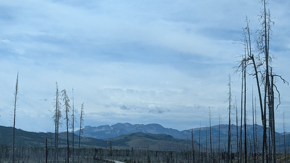
Sites like Obsidian Cliff are right off the road, and give us as visitors an insight on life 11-8,000 years ago. Native people used the obsidian from here to make spear heads, used to hunt smaller animals at that time, as well as other tools now mostly set in museums; there have been many found in the area. During the Archaic period it is likely they hunted mostly bison, rabbits, deer, goats, sheep, birds, and more. There are more than 2,000 sites in the park itself, some of which you can visit today, and walk through historical paths likely used since the Paleoindian period. Obsidian cliff is a popular stop, as it has 98 feet of exposed obsidian on its face, it also is the primary ‘birth place’ so to say of most obsidian in the midwest, as it goes down waterways and spreads. In 1988 there was a massive fire that burned a lot of Yellowstone, down into the Teton area. The obsidian cliff had previously been densely covered in trees, now visible to archeologists they found a lot more sites, and discarded tool pieces. There is a small kiosk located near the cliff constructed in 1931, with information about the area and its archaeological history.

About 3,000 years ago the Yellowstone area really boomed, with the increased bison hunting and abundant food sources. Around 1,500 years ago they started hunting with bows and arrows, increasing their food sources again.
Less than 3% of the park has actually been documented since the archeology program began in 1995. Somewhat having to do with the construction, hazard fuel reduction, and other types of regulations that keep protected areas preserved, but many sites have also been combined, eroded, flooded, burned and more, making them no longer viable places. You’ll find most of the sites to be within developed areas, also making them more accessible to you. Most of the history as we know it is based on found artifacts, and oral tellings. Distinguishing for certainty who used what items for what may never be exactly known, but we can use context clues to make viable theories about tribes activity, lifestyles, and more. As temperatures rise and fires are more prevalent, more areas become susceptible to more fires, flooding, and more, making many yet to be found, or finished, sites lost or completely destroyed.
During the 2019 archeological season, excavations around the Lake Lodge area uncovered more than 450 artifacts. These items, tracing back to the turn of the century and late 1800s, seem to be tied to daily meals, including pieces of ceramic tableware, glass bottles, utensils, and remnants of butchered animal bones. Giving us a rare look into how tourism and leisure evolved in Yellowstone over the last 140 years.
The Kiowa have stories passed down orally from around the 1400s, surviving the little ice age, in the 1600s the Crow had arrived too, by the 1700s Lakota Sioux also had claims to the area. In the 16-1700s horses became popular amongst tribes, and by the 1700s the fur trade was booming.
The Tukudika, or Sheep Eaters, were around for a very long time, they were from what is now Montana. The names assigned by the Shoshone people were often based on what the people did, ate, or where they were, which is where the name Sheep Eater came from, they ate big horned sheep, as they were very common in the areas they frequented, though they did eat many other things too. From this information it’s assumed they were often in the southern end of the current border.
Chief Togwotee was the Tukudika guide for President Chester A. Arthur’s 1883 trip through Yellowstone.
The Tukudika were primarily traveling in family groups, they mined obsidian from Obsidian Cliff, they hunted, trapped, fished, traded, and more seasonally in the area. Their shelters were typically similar to a wickup, a simple shelter made of lodgepoles and native plants, set well into the ground and held up well to the area's harsh weathers. They even used the thermal pools, springs, and vents, to their advantages, cooking food, or softening horns and sinew used to make weapons and tools. Bows made of the bighorn sheep horns were particularly effective, precise, and highly sought after, so much so that they traded them all the way down to the Rocky Mountain area. Unlike many in the area they did not soon adapt to horses, they instead were often on foot, with their dogs (satii, sadee resembling both wolves and huskies) who have been found buried with their owners throughout the park lines today. Steatite deposits can be found throughout the park, also known as soapstone, it’s a fairly pliable mineral used by some tribes to make things like bowls, or containers to store food in. Even after the park was established they remained in the area, eventually being merged into Wyoming's Eastern Shoshone tribe at the Wind River Reservation, as well as the Mountain and Lemhi Shoshone and Bannock peoples residing on southeastern Idaho's Fort Hall Reservation. This, obviously, disrupted a lot of their lifestyle.
By the late 1700s the fur trade had really taken off, traders came from far in hopes to trade with the native people, they likely didn’t see as much of the thermal features as we do today, other than from being told about some by native acquaintances.
1804-1806 the Lewis and Clark Expedition passed what’s now the park; they didn’t travel much of the river beyond what’s now Livingston Montana. John Colter though, left the expedition to join trappers in the area, he likely did travel the outskirts of Yellowstone lake, to cross the Yellowstone River near Tower Fall, where he noted the presence of “Hot Spring Brimstone.”. More on him in the Tetons History.
The war of 1812 took a lot of people, and money, away from park exploration, by the 1820s though trappers returned to the Rocky Mountain area, and trading resumed. One of those men, Daniel Potts, is credited with publishing the very first narrative of the region's wonders via a letter sent to a Philadelphia newspaper. Similarly, Osborne Russell recorded his experiences of fur trapping across the Yellowstone landscape during the 1830s and into the early 1840s, providing further documentation of the area's early history. Another famous name Jim Bridger came back to trap, telling tall tales around fires that inspired many to join the ‘profession’. By the 1850s beaver was out, many trappers moved to guide work, or other things.
From 1863-1871 many gold prospectors came though the area, small sections were found on the outskirts of the park, but nothing of note within the borders.
Though not successful the first expedition was in 1860 when Captain William F. Raynolds led a military expedition that was stopped by spring snow, then the civil war took resources away from any more expeditions for a few years, then some were planned but never done.
The 1869 Folsom-Cook-Peterson Expedition was conducted by David E. Folsom, Charles W. Cook, and William Peterson, despite warnings not to, because of “indian trouble” and saying it was basically suicide. They traveled from Bozemen, between the Gallatin and Yellowstone rivers, crossed the mountains to the Yellowstone and continued into the present park, where they took what is basically the current route to West Thumb, making all the stops along the way. They visited Shoshone lake, and the basins along the Firehole River. Their expedition updated an old map (DeLacy 1865) and inspired many people with a magazine article.
In 1870 the Washburn-Langford-Doane Expedition was conducted, led by Surveyor-General Henry D. Washburn, Montana politician and businessman Nathaniel P. Langford, and attorney Cornelius Hedges. Lt. Gustavus C. Doane provided military escort from Fort Ellis (near present-day Bozeman, Montana). Notably this expedition covered Tower Fall, Canyon, and Yellowstone Lake, the Lower, Midway, and Upper geyser basins (where they named Old Faithful). They also provided a lot of measurements for a lot of prominent features.
The famous Hayden Expedition conducted in 1871 was led by Ferdinand V. Hayden, head of the US Geological and Geographical Survey of the Territories, at the same time as a survey by the US Army Corps of Engineers. This expedition was the beginning of science in the park, with survey team including two botanists, a meteorologist, a zoologist, an ornithologist, a mineralogist, a topographer, and an agricultural statistician/entomologist, in addition to an artist, a photographer, and support staff. Once again updating the map more, and the photographs by William Henry Jackson and the art of Henry W. Elliot and Thomas Moran gave everyone a glimpse into the gem that is Yellowstone.

In 1871-1872 Langford promoted a bill proposed in Washington that related to the Yosemite Act of 1864, where Yosemite Valley was entrusted to California to keep it preserved. They wanted to stop all private ownership in the park, and they succeeded, thanks to the hayden expedition, just 6 months later it passed. Arguments between Wyoming and Montana territories that year resulted in a decision to federalize Yellowstone, officially making it the very first national park.
In the early years, no one wanted to put more money towards the park, Hayden himself as superintendent may have only entered the park twice in the 5 years he had the unpaid, unsupervised job. Once for the 1872 expedition, and once to evict a squatter. Langford tried to preserve the park as much as he could with no laws protecting anything in the park itself, with no money and no rangers, he did manage to do a lot in that time. In 1877, Langford was pushed out due to political pressure, Philetus W. Norris was appointed the next superintendent, and the next year, Congress authorized appropriations “to protect, preserve, and improve the Park.”
Norris, with lots of money, political power, and resources, built roads, built a headquarters in Mammoth, hired a gamekeeper, and really cracked down on hunters and vandals. He also created the Grand Loop Road, and heavily expanded the map with his explorations. During his time, he was amidst a war between many native tribes and the US government. His response was to tell people that native people were afraid of the thermal features, and wouldn’t come near, a blatant lie, though it worked, it spread. Eventually his political power failed him and he was removed as superintendent in 1882, succeeded by 3 who failed to do much for the preservation of the park at all. At one point there were 10 superintendents at once all allowed to act as police, and yet vandalism, hunting, poaching, squatting, woodcutters and other types of people who destroy the land, had free reign.

By 1886 congress didn’t want to send any more money to a failing administration, so they took over. The Secretary of the Interior, under authority given by the Congress, called on the Secretary of War for assistance, the army enforced rules in the park, protected areas, stood post at thermal features, evicted troublemakers, and cavalry patrolled the vast interior. By 1894 poaching was so out of hand the army arrested a man, Ed Howell, for killing a bison, which would typically only result in banishment from the park. Emerson Hough, a reporter, was present at the arrest and wired his report to Forest & Stream, a popular magazine of the time, where its editor, renowned naturalist George Bird Grinnell, helped create a national outcry. Within a couple of months Congress passed the National Park Protection Act, also known as the first Lacy Act. This Act allowed the soldiers more control, more ability to have proper ‘punishments’. Though the soldiers weren’t a great look for the park, they were the only of 14 who weren’t separately administered, and the soldiers couldn’t satisfy visitors' wants for information on everything and anything in the park.
From 1872 to the early 1900s the management in the area was a model for what would become the park service, an agency whose sole purpose was to manage the national parks. The National Park Service Organic Act was passed by Congress and approved by President Woodrow Wilson in 1916. Yellowstone’s first rangers, which included veterans of Army service in the park, became responsible for Yellowstone in 1918. The park’s first superintendent under the new National Park Service was Horace M. Albright, who served simultaneously as assistant to Stephen T. Mather, Director of the National Park Service. Albright established a management framework that guided administration of Yellowstone for decades.
In 1929, President Hoover signed the first bill changing the park’s boundaries after much deliberation between the park service, and the people who lived in the areas. It also follows natural features better, including following the Yellowstone River. In 1932, President Hoover issued an executive order that added more than 7,000 acres between the north boundary and the Yellowstone River, west of Gardiner. These lands provided winter range for elk and other mammals. At the same time, everyone wanted the water from the park, proposals included damming the southwest corner of the park, but unlike in the Tetons, where Idaho uses water from inside the park, Yellowstone remains free from that kind of exploitation.
During WWII there were many issues going on, from unfinished projects including the road from Old Faithful to Craig Pass, to a lack of employees, visitors, and lack of money being directed to the park. Soon there were discussions of using the park's resources for war efforts, which never did happen.
By 1948, park visitation reached one million people per year, though the budget didn’t go back up.
Mission 66 came from National Park Service Director Conrad Wirth in 1955, he persuaded congress to fund an improvement program for completion by the National Park Service’s 50th anniversary in 1966. Though originally meant to improve employee housing and educational programs, the money mostly went to making the whole park ‘Park Service Modern’ style, and building new roads. The first Mission 66 project initiated by the National Park Service, Canyon Village, opened in July 1957.
Associated Tribes - Yellowstone National Park (U.S. National Park Service). (n.d.). https://www.nps.gov/yell/learn/historyculture/associatedtribes.htm
Archeology - Yellowstone National Park (U.S. National Park Service). (n.d.). https://www.nps.gov/yell/learn/historyculture/archeology.htm
Birth of a National Park - Yellowstone National Park (U.S. National Park Service). (n.d.). https://www.nps.gov/yell/learn/historyculture/yellowstoneestablishment.htm
European Americans arrive - Yellowstone National Park (U.S. National Park Service). (n.d.). https://www.nps.gov/yell/learn/historyculture/european-americans-arrive.htm
Expeditions Explore Yellowstone - Yellowstone National Park (U.S. National Park Service). (n.d.). https://www.nps.gov/yell/learn/historyculture/expeditions.htm
Historic Tribes - Yellowstone National Park (U.S. National Park Service). (n.d.). https://www.nps.gov/yell/learn/historyculture/historic-tribes.htm
Places - Yellowstone National Park (U.S. National Park Service). (n.d.). https://www.nps.gov/yell/learn/historyculture/places.htm
The earliest humans in Yellowstone - Yellowstone National Park (U.S. National Park Service). (n.d.). https://www.nps.gov/yell/learn/historyculture/earliest-humans.htm
Timeline of human history in Yellowstone - Yellowstone National Park (U.S. National Park Service). (n.d.). https://www.nps.gov/yell/learn/historyculture/timeline.htm


Comments