The Grand Tetons
While not actually attached to Yellowstone, the stunning beauty of the Tetons is absolutely worth the visit.
With a lack of foothills in the park it looks like the peaks shoot 7,000 feet right out of the valley, but they’re further than they look.
The name comes from 19th century French fur trappers who called them "les trois tétons" (meaning "the three breasts" or "teats") because of the three sections of the mountains. Before that the Shoshone people called it "Teewinot" which translates to "many pinnacles". Calling the area the Grand Tetons was normalized by mapmakers later.
Despite having 2-billion-year-old metamorphic rock (some of the oldest on Earth), the Teton Range itself is one of the youngest mountain ranges in the Rocky Mountains at only about 9 million years old.
The park wouldn't be as massive as it is today without the conservation efforts of John D. Rockefeller Jr., who secretly purchased over 30,000 acres in the Jackson Hole area in the 1920s to eventually donate to the federal government.
The top 33 feet of water on any lake in the park actually belongs to Idaho, who uses it to help potato farmers when in drought.
More than 400 types of birds flock to the area every year, including trumpeter swans, the largest water birds in North America.
There are more than 200 miles of trails inside the park lines, many of which are backcountry trails.
This is basically in order driving south from Yellowstone through the Tetons, starting where the South Entrance Road section ends, after Colter Bay;

Trails;
Signal Mountain Summit - Has a road up part of the way, or take the hiking trails to it, starting at the Signal Mountain Lodge. The trail is about an 8 mile loop, climbing about 1,200 feet to thesummit. The summit is more than 7,700 feet, so make sure you bring enough water! Elevation will likely make you more winded, if you've had issues with elevation and breathing before, consider bringing an emergency oxygen can, they're available at most stores in and around the area.
Jackson Point Overlook - Located just off the road near the Signal Mountain Lodge turn
Leigh Lake Trailhead - just less than 2 miles out and back to Leigh Lake Shores, along String Lake, and connects into longer trails from here.
Paintbrush Canyon Trail- Is 9.1 miles long one-way up to the Paintbrush Divide, but it is most famously hiked as part of the 19.9-mile Paintbrush Canyon-Cascade Canyon Loop. There is no backpacking on this trail directly.
Hidden Falls Trail - a short hike to a 100 ft waterfall, definatly worth the stop for something easier.
String Lake Trailhead - The trail is about 3 miles around string lake, or walk all the way down to or around Jenny lake.
Jenny Lake Trailhead - Located at Jenny Campground/Visitor Center area, can be up to 8 miles depending on the path you take, would recommend Inspiration Point at the least, you can also take the shuttle boat out this way to cut out the first part of the hikes and continue a longer one across the lake.
Moose Ponds Loop Trail - About 3 miles out and back to an area where moose are commonly spotted drinking from the ponds.
Cascade Canyon Start - The trail is about 9.5 miles round from the Start trailhead, or 13 from the Jenny Lake Trailhead area. This is one of the more famous/popular trails in the park, and for good reason.
Hidden Falls - The trail is 9.1 miles long one-way up to the Paintbrush Divide, but it is most famously hiked as part of the 19.9-mile Paintbrush Canyon-Cascade Canyon Loop. There is no backpacking on this trail directly.
Inspiration Point - About 1 mile from the boat dock, or 5-6 from Jenny Lake Trailhead. This is the famous picture spot in the park, with views of the whole valley. From here you can also see the effects of the glaciers that left the valley behind. The lake itself was named after a Shoshone woman, who had married a 19-century trapper who was living in the area.
South Fork Cascade Canyon Trail - A 12 mile out and back from the trailhead start, or about a 20 mile hike from Jenny Lake area, which takes you to Hurricane Pass along Cascade Creek
Lupine Meadows Trailhead - connects into many trails splitting about 3 miles in, Delta Lake is 7.4 to 8 miles round-trip, Garnet Canyon is 8.4 miles round-trip, Surprise and Amphitheater Lakes are 9.8 to 10.1 miles round-trip and Lower Saddle (Grand Teton climb route) is 13.5 miles round-trip.
Taggart Lake Trailhead - is about 3 miles on a loop trail to Taggart Lake
Blacktail Butte Trailhead - 5-8 miles depending on trail choices, goes up the side of the mountain a bit then flattens out for the rest of the trail.
Schwabacher Landing - half a mile to the main point or 1.5 miles to the end and back. Goes along the Snake River. Active beaver dams frequently change the river, don’t get too close to them, they are pretty fiercely protective of their homes. Moose, bald eagles, deer, and river otters are regular visitors to the river shores. You'll likely see the cars at the bottom of the road before the trailhead, this is a pretty famous spot.
Off 191 is the Wilderness Access Road, this can take you far into the wilderness area where there is dispersed camping, and many backpacking trails. There is also the Gros Wilderness Venture, which I'll make another post about. As well as other forest access roads that lead into wilderness areas.
Viewpoints;
Willow Flats - pull out area with a scenic view of the Tetons and the lake
Teton Park Road - is the next road to the west, this takes you into the lower section of the park (the valley), directly to-
The Jackson Dam and Overlook - would recommend walking around here it’s pretty
Potholes Turnout - Lookout point with close up of the Teton points.
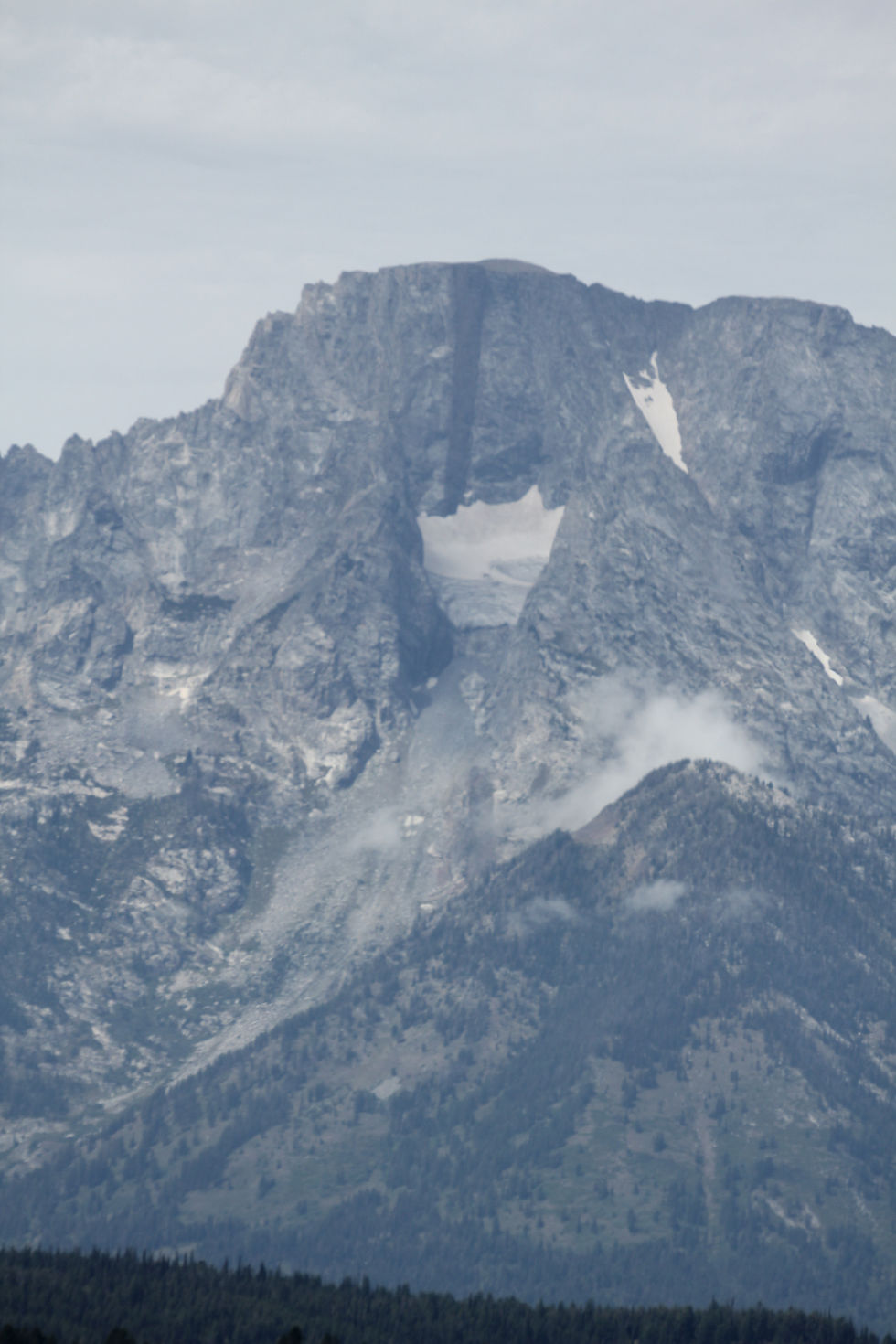
Mount Moran Turnout - Has informational plaque about Moran Mountain. It was named after the painter, Thoman Moran, most famous for his painting of the Grand Canyon of Yellowstone waterfall. It stands out against the other peaks, as it has more of a blocky shape than any other. You may also notice the dark streak on the face, created by the magma that formed it.
Signal Mountain Summit - has a road or hiking trails to it, overlooks the Dam
Mountain View Turnout
Jenny Lake Overlook
Geraldine Lucas Homestead - Located south of Jenny Lake. In 1924, at age 58, Lucas became the second recorded woman to summit the 13,775 foot Grand Teton. Her hired guide, Paul Petzoldt, was a 16-year-old teenager. John D. Rockefeller Jr. spent years trying to buy up the valley via a front company to create the national park. Lucas fiercely resisted, declaring, "You stack up those silver dollars as high as the Grand Teton and I might talk to you!". Her land remained hers until her death in 1938. Ironically, the property was later purchased and used as a summer residence by Harold Fabian, the very lawyer spearheading Rockefeller's land acquisition. To secure her 160-acre patent under the Homestead Act, federal law required her to cultivate crops. Because she hated farming, she grew exactly what the law mandated, immediately abandoned the fields once approved, and focused solely on her personal garden. When winter snow cut off the valley, she didn't stay inside. She mushed a personal team of Alaskan Malamutes and sled down to the town of Moose just to pick up her mail. Her grave and memorial are still located on the edge of the property.
Teton Glacier Turnout
Windy Point Turnout
Closer to Jackson is the National Museum of Wildlife Art, which has trails with statues as well a very large and beautiful inside with lots of art, and information, about the area.
Heading back up 89 towards Yellowstone -
Blacktail Ponds Overlook
Mormon Row - located off Antelope Flats Rd, see the world-famous T.A. Moulton Barn, a unique clustered settlement design, and historic hand-dug irrigation ditches. Originally called Grovont,after the Gros Venture River, it was built in the 1890s by, you guessed it, Mormons. The T.A. Moulton Barn is widely considered the single most photographed barn in the entire world. Winter water required breaking ice or hauling buckets from the river until a geological shift warmed nearby springs in 1927. The sagebrush flats surrounding the historic district are frequent grazing grounds for local pronghorn and the Jackson Hole bison herd.
Kelly Campus of Teton Science Schools - located a ways out could be worth a stop if you want to possibly ask some of the scientists what they are working on in the parks these days.
Glacier View Turnout
The Airport - Jackson Hole Airport often hasplanes coming and going.
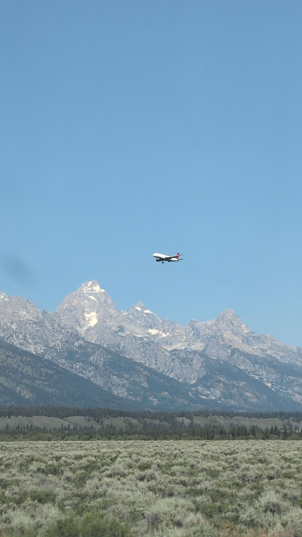
Teton Point Turnout
Snake River Overlook
J.P. Cunningham Cabin - can walk around about a half mile of trail, built in 1888, it uses an Appalachian "dogtrot" or "double-pen" design with two small rooms connected by a central, open-air covered breezeway. After 1895, when a larger main house was finished, the original cabin served as a blacksmith shop (forge) and a barn. A posse led by a supposed U.S. Marshal ambushed and killed two suspected horse thieves whom Cunningham had allowed to spend the winter in his cabin. The true identity of the marshal and the guilt of the men were never proven. In 1899, the short-lived Elk Post Office operated out of the ranch with John’s wife, Maggie, serving as the postmaster. John Cunningham also served as a local justice of the peace, game warden, and one of Teton County's original county commissioners.
Elk Ranch Flats Turnout
Oxbow Bend
Cattleman's Bridge Site - Water access, paddling allowed, a less crowded area typically.
Animals;
Black bears and grizzlies, elk, bison, moose, beavers, birds, marmots, and more
City Things;
Jenny Lake Visitor Center
Dornan's Pizza Pasta Company - in Moose
The Maud Noble Cabin - in Moose, is a small museum
Menors Ferry Historic District - in Moose, is a popular historic site
Murie Ranch Historic District
Craig Thomas Discovery and Visitor Center
National Museum of Wildlife Art
Camping;
Signal Mountain Campground - Located off Teton Park Rd
Jenny Lake Campground

Comments